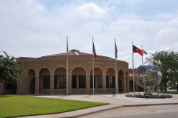
Affiliation:
Texas Tech University
Mailing address:
ICASALS
P.O. Box 41036
Lubbock, TX 79409-1036
USA
E-Mail: icasals@ttu.edu
Phone: (+1-806)-742-2218
Fax: (+1-806)-742-1954
Mission statement
The International Center for Arid and Semiarid Land Studies’ (ICASALS) mission is to promote and facilitate multidisciplinary initiatives in research, education and regional development programs that address the understanding of processes caused by natural phenomena and by the human presence in arid and semiarid lands. ICASALS’ mission is focused on water related issues, one of Texas Tech overarching strategic priorities.
The environment of the location
Lubbock, Texas, USA (33.59° N, 101.89° W) is situated in a semiarid region in the Southwest of the United States. More than 50 percent of Texas, approximately one-third of the United States and one-third of the Earth’s land surface are classified as arid or semiarid. ICASALS is adjacent to arid regions in New Mexico as well as the US – Mexico border making Texas Tech University ideally suited for arid and semiarid research activities.
History and milestones
ICASALS was established in August of 1966 by the Texas Tech Board of Directors through a unanimous decision. President Grover Murray was inspired to create a special international mission for Texas Tech during his travels to North Africa. He intended for ICASALS to bring world-wide distinction to the University and to involve the efforts of all the educational departments and resources. The geographic location of Texas Tech made the study of arid and semiarid lands appropriate. ICASALS provides a means by which Texas Tech University is able to make global contributions.
ICASALS coordinates the Graduate School’s Interdisciplinary Master’s Program focused on Arid Land Studies and International Development that allows students to take courses from different academic departments at Texas Tech. A student in the Arid Land Studies study track takes courses in Agricultural Science and Natural Resources, Earth Sciences, and in Water Resources and Environmental Toxicology. A student registered in the International Development study track takes courses in Agriculture and Applied Economics, Planning and Sustainable Development, and Politics and Public Administration.
ICASALS celebrated its 40th anniversary in with an International Conference on Water in Arid and Semiarid Lands: Innovative Approaches and Informed Decision-Making, which was held at Texas Tech University on November 15-17, 2006. The topics addressed during this meeting included: water resource management, water law, agricultural practice in drylands, landscape architecture, soil salination, crop genetics, remote sensing and GIS technologies, ecology, ecotoxicology, energy supply, climate and weather, and international programs among other themes.
The Second International Conference, Water in Arid and Semiarid Lands was held from September 9 – 12, 2007 in the city of Gravatá (Pernambuco), Brazil. This meeting was co-sponsored by the Brazilian Association of Water Resources (Associação Brasileira de Recursos Hídricos, ABRH) and the Federal University of Pernambuco (Universidade Federal de Pernambuco, UFPE). Conference presentations addressed the development and use of water resources in drylands with an emphasis on the improvements made on traditional and innovative agriculture. The Third International Conference is planned for June 2009 in Cape Verde.
Structure
ICASALS primarily with approximately sixty Faculty Associates, but any Texas Tech faculty member or student can collaborate in Center projects. The main areas of interest are the development of drought resistant crops, water reuse systems, high-value crop production systems, rural economic development, strategies to control the erosion of productive soil, water resources, use and conservation of natural resources, food processing, the social and historical studies of life in the world’s arid regions and the application of remote sensing and GIS technologies.

